PlaceCrafter: Curating Urban Functional Regions through Platial Clustering
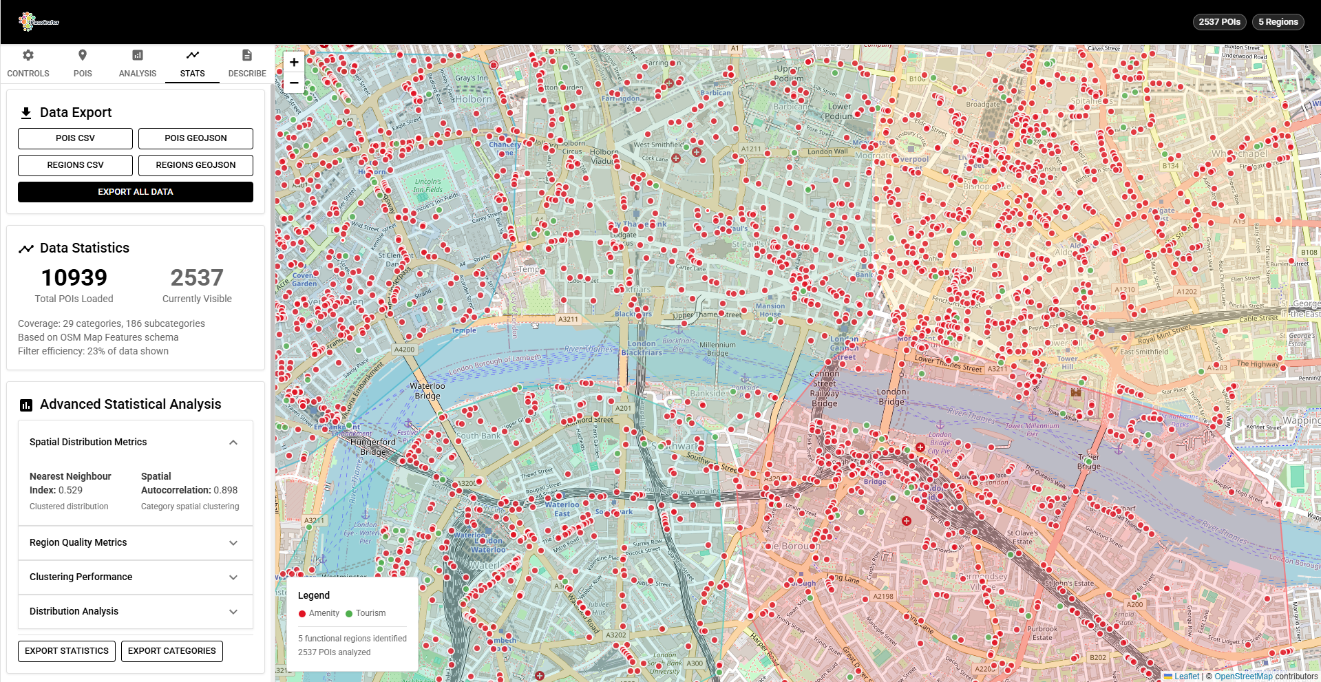
PlaceCrafter is a web-based platform that enables researchers to identify meaningful urban regions through clustering OpenStreetMap Points of Interest. Built with React, Leaflet, and D3.js, it provides interactive clustering, statistical validation, and platial visualisation of how cities are actually used.