Projects & Systems
Geospatial AI, humanitarian data infrastructure, urban planning intelligence, and the computational geography of human experience.
Featured
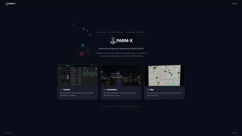
PARM-X
A multi-screen web platform for projecting live geospatial data, simulations, and interactive experiences onto 3D physical city models.
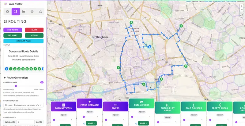
WalkGrid
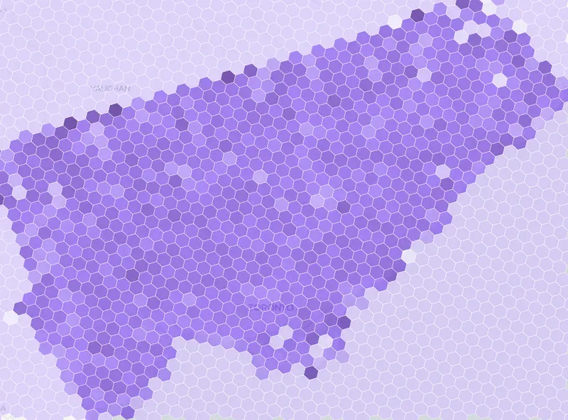
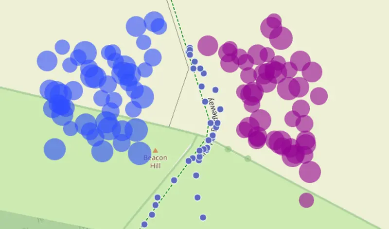
A computational platform for curating engaging walking routes enriched with environmental context, personal preferences, and scalable spatial analysis using H3 hexagonal indexing.
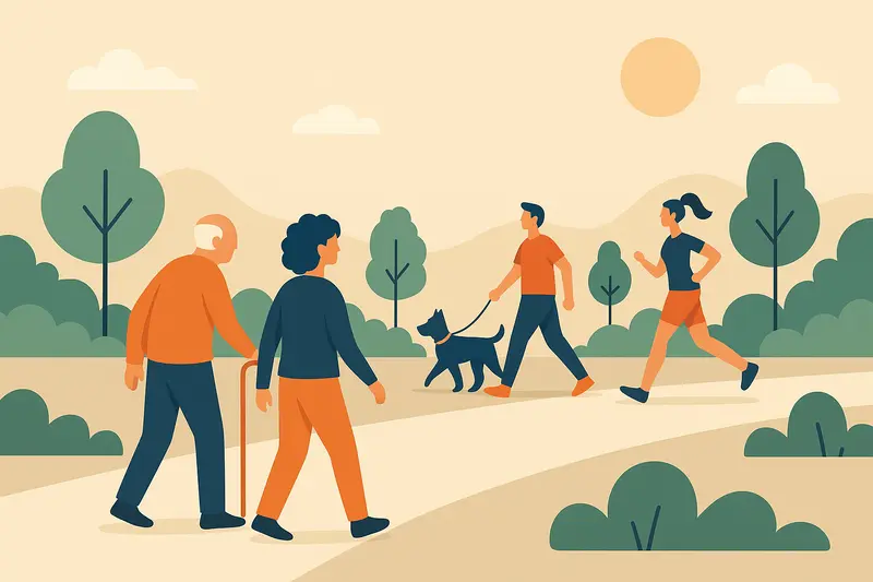
Leisure Walking Systems Working Group
An EPSRC-funded academic-industry impact initiative producing open technical documentation, design frameworks, and evaluation tools for place-based walking systems.
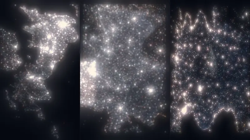
GeoAI
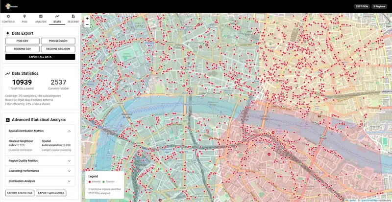
A web-based geospatial framework for identifying and visualizing 'platial' functional regions by clustering OpenStreetMap Points of Interest.
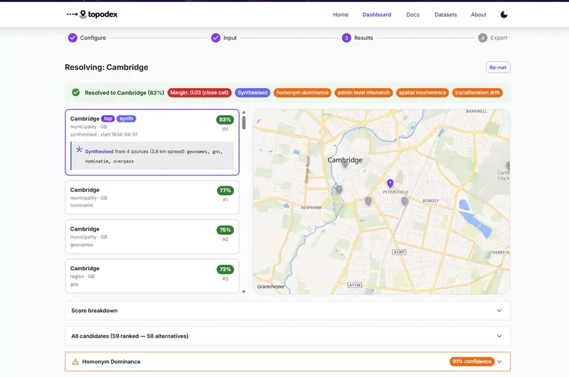
Contextual geocoding and spatial coherence validation for conflict and human rights text corpora.
A computational platform for curating engaging walking routes enriched with environmental context, personal preferences, and scalable spatial analysis using H3 hexagonal indexing.
AI and ML
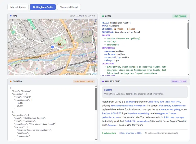
A human-curated, LLM-native open format for representing geospatial places as semantic objects — legible to people, machines, and AI.
Morphological Embedding Model for Urban Experience — embedding urban morphology into vector space to find city twins across the world.
Big Data
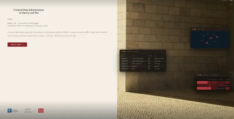
A Docker-based research data platform for the systematic aggregation, classification, and cross-layer querying of datasets at the intersection of slavery and armed conflict.
A fused, confidence-scored point-of-interest dataset combining OpenStreetMap and Overture Maps Foundation data at national scale — published as GeoParquet and PMTiles.
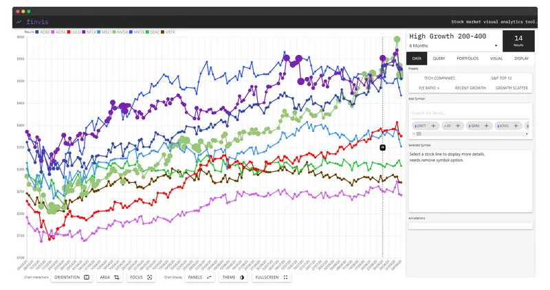
A web-based exploratory visual analysis platform for stock market data — enabling custom queries across 500+ stocks, comparative portfolio visualisations, and interactive display customisation via financial API.
Places
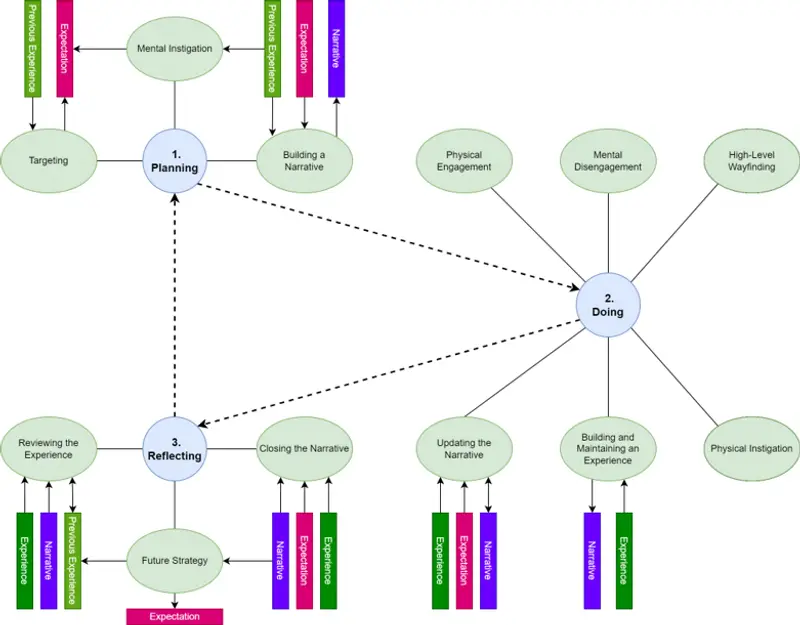
A grounded-theory framework bridging subjective human walking narratives and computational routing systems — operationalising experiential place qualities for next-generation walking applications.
A Contextual GIS framework for capturing and analyzing the subjective 'Sense of Place' in leisure walks by linking video narratives with geospatial data.
A multi-screen web platform for projecting live geospatial data, simulations, and interactive experiences onto 3D physical city models.
A Royal Society-funded STEM partnership project where T Level Data Analytics students at Halesowen College design, build, and deploy air quality sensors around the college estate.
An EPSRC-funded academic-industry impact initiative producing open technical documentation, design frameworks, and evaluation tools for place-based walking systems.