← All topics
OpenStreetMap
OpenStreetMap
2 posts
05 Oct 2025 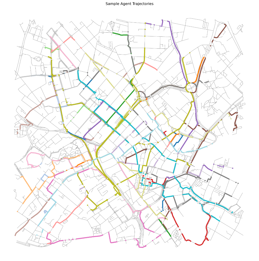 03 Oct 2025
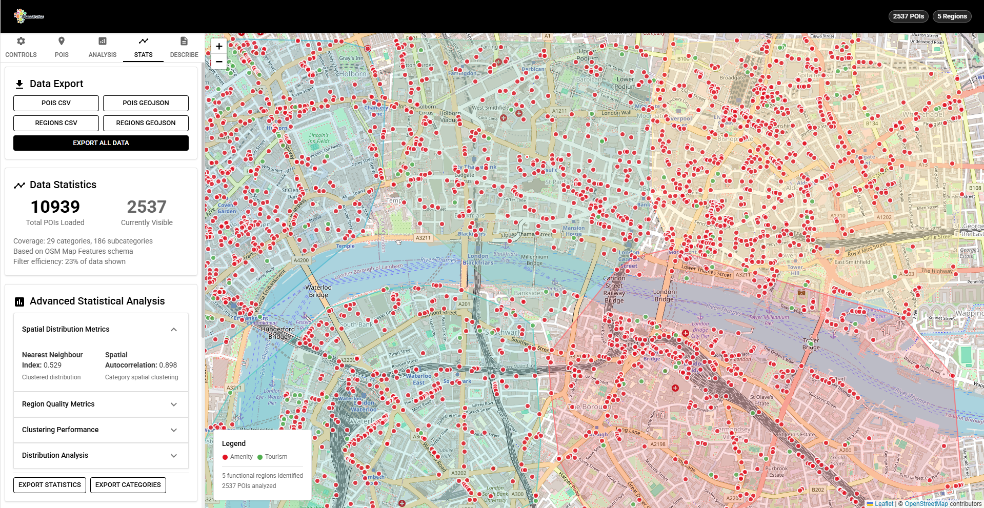
PlaceAgents: Modelling Multi-Stop Pedestrian Itineraries as Platial Flows
PlaceAgents is an open-source framework for simulating platial pedestrian flows in urban environments. Using OpenStreetMap data, H3 spatial indexing, and interpretable routing algorithms, it models how people chain together sequences of places for errands, work, and leisure.
03 Oct 2025 PlaceCrafter: Curating Urban Functional Regions through Platial Clustering
PlaceCrafter is a web-based platform that enables researchers to identify meaningful urban regions through clustering OpenStreetMap Points of Interest. Built with React, Leaflet, and D3.js, it provides interactive clustering, statistical validation, and platial visualisation of how cities are actually used.