Research
GeoAI &
Spatial Science.
Geospatial foundation models, graph neural networks, and conflict data infrastructure — bridging spatial AI with real-world impact.
Research Vision
Building AI systems that operate across cities, conflict zones, and global datasets — combining graph neural networks, LLMs, and cloud infrastructure to capture how geographic space is structured, used, and understood.
Focus Areas
Research Themes
GeoAI & Foundation Models
Geospatial foundation models, graph neural networks for spatial representation, and discrete global grid systems (H3) for city-scale analysis.
View projectsConflict & Humanitarian Data
Cloud-native infrastructure for conflict documentation and displacement analysis, supporting interdisciplinary research into slavery and war.
View projectsUrban Intelligence & Mobility
Data-driven analysis of urban place and active transportation using satellite data, crowdsourced trajectories, and civic APIs.
View projectsPortfolio
Featured Project
Featured
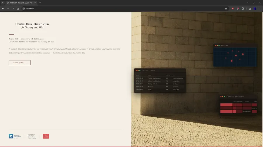
CDISaW
Centralised Data Infrastructure for Slavery and War — a unified query layer over dispersed, heterogeneous datasets on slavery and war across space and time.
Scholarship
Recent Publications
Systems
Selected Projects
PlaceCrafter
A web-based geospatial framework for identifying and visualizing 'platial' functional regions by clustering OpenStreetMap Points of Interest.
Leisure Walking Framework
A comprehensive, grounded-theory framework for curating personalised leisure walking experiences, creating a bridge between subjective human narratives and computational routing systems.
Topodex
Contextual AI Geocoding for Evidence Research — a five-stage pipeline running nine parallel geocoding backends to resolve ambiguous place references in slavery, displacement, and war scholarship.