Research
Projects &
Systems.
Geospatial AI, humanitarian data infrastructure, urban planning intelligence, and the computational geography of human experience — built across academic and applied contexts.
These projects sit at difficult intersections — between data and experience, historical evidence and living place, algorithmic precision and the human desire to understand somewhere.
Across four research themes, the underlying commitment is the same: that place is computable, and that getting the computation right is what makes the answers matter.
GeoAI & Representation Learning
“What would it take to teach a machine to read a neighbourhood — its character, its texture, its urban twin on the other side of the world?”
Machine learning models of urban form and place — spatial feature engineering, neural embeddings, similarity algorithms, and LLM-mediated preference elicitation applied to city-scale geographies.
 Ongoing
 PlaceCrafter
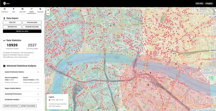
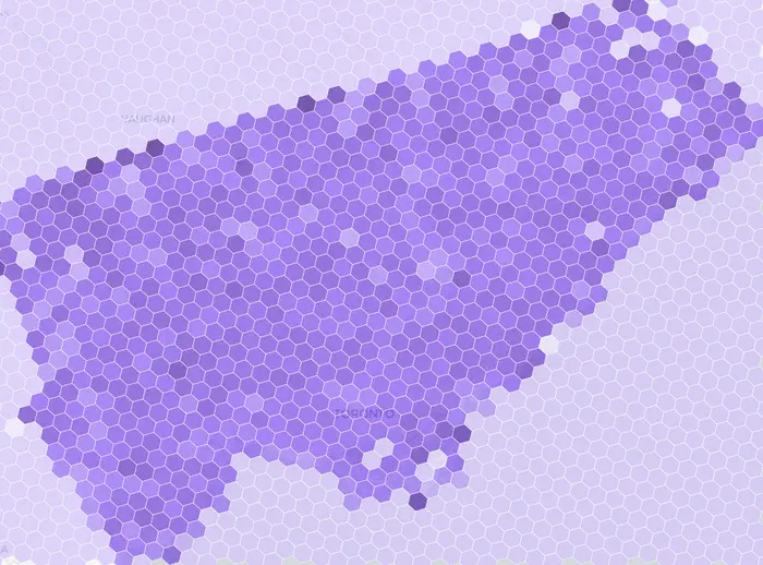
A web-based geospatial framework for identifying and visualizing 'platial' functional regions by clustering OpenStreetMap Points of Interest.
View project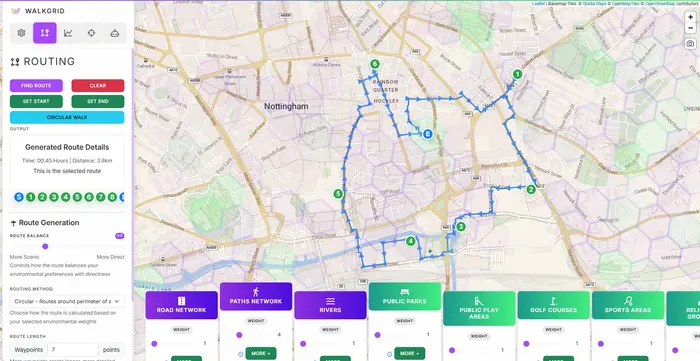 Completed
 WalkGrid
A computational platform for curating engaging walking routes enriched with environmental context, personal preferences, and scalable spatial analysis using H3 hexagonal indexing.
View projectConflict & Humanitarian Data
“When evidence for slavery and war is scattered, contested, or deliberately erased — how do we build systems that put it precisely in place?”
Spatial data infrastructure for the historical and contemporary study of slavery, conflict, and displacement — geocoding pipelines, data integration, probabilistic place reconstruction, and evidence-based spatial analysis.
 Ongoing
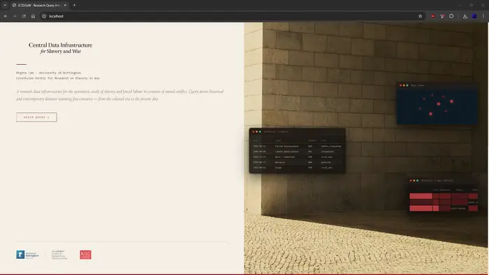
 CDISaW
Centralised Data Infrastructure for Slavery and War — a unified query layer over dispersed, heterogeneous datasets on slavery and war across space and time.
View project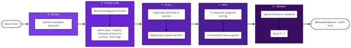 Ongoing
 Topodex
Contextual AI Geocoding for Evidence Research — a five-stage pipeline running nine parallel geocoding backends to resolve ambiguous place references in slavery, displacement, and war scholarship.
View projectUrban Intelligence & Mobility
“How can spatial data make cities more transparent, more responsive, and more liveable for the people who use them?”
Geospatial platforms for urban planning, active travel, and environmental monitoring — combining IoT sensors, interactive visualisation, and multi-source data for local government and community use.
 Ongoing
 MORPHEME
Morphological Embedding Model for Urban Experience — embedding urban morphology into vector space to find city twins across the world.
View project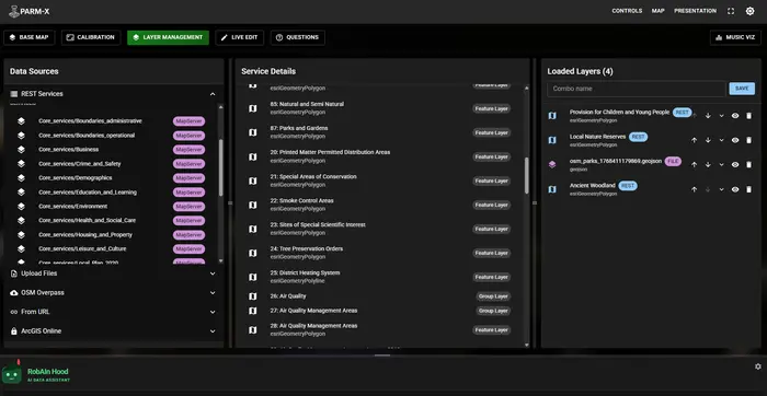 Ongoing
 PARM-X
An Interactive Projection Augmented Relief Model Web Platform for visualizing and interacting with geospatial data over physical relief models.
View projectHalesAir
A Royal Society-funded STEM partnership project where T Level Data Analytics students at Halesowen College design, build, and deploy air quality sensors around the college estate.
View projectNewman Active Travel Network
A student-staff partnership project focused on mapping and improving active travel routes around Birmingham Newman University.
View projectPlaces & Lived Experiences
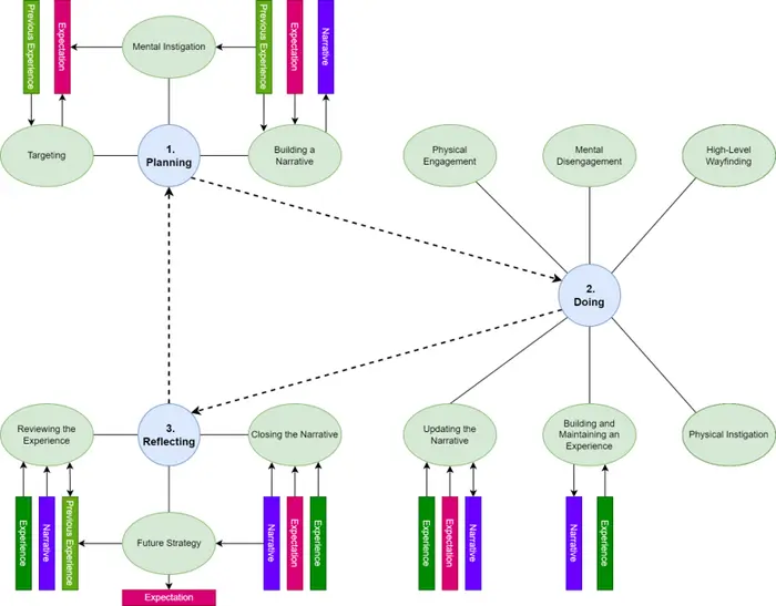
“What if a routing system understood not just where you want to go, but how you want to feel when you get there?”
Capturing the subjective, experiential dimensions of place — from grounded-theory frameworks for leisure walking to spatial video narratives and platial systems working group initiatives.
 Completed
 Leisure Walking Framework
A comprehensive, grounded-theory framework for curating personalised leisure walking experiences, creating a bridge between subjective human narratives and computational routing systems.
View project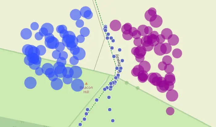 Completed
 WalkGIS
A Contextual GIS framework for capturing and analyzing the subjective 'Sense of Place' in leisure walks by linking video narratives with geospatial data.
View project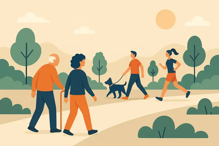 Completed
 Leisure Walking Systems Working Group
A collaborative impact initiative bridging the gap between academic research and industry practice to create safer, more engaging digital walking experiences.
View project